 Tutorials, lessons and training modules
The Bilko software is supported by lessons that teach image analysis and interpretation. The lessons are designed for students and teachers working on their own with limited support, and come complete with background information, images, palettes, formulae and other tools needed to complete the work.
Bilko aims to promote active learning. Step-by-step instructions for hands-on activities are followed by questions to test student understanding. All questions are provided with model answers that explain the reasoning behind the interpretation suggested.
Tutorials and lessons are available either in PDF format or as 'web pages' (HTML format) that may be downloaded and used off-line with a suitable web browser. There are four broad categories:

Tutorials show how to use the Bilko software, and teach common image processing techniques. They are divided into sections that may be completed in around 1 hour.
Mini-lessons are short tutorials on specific, advanced image processing topics; they may be completed in around 1 hour.
Lessons generally demonstrate different applications of remote sensing, or the use of data from a particular remote sensing mission. They are more extensive and usually take 2-3 hours to complete.
Training Modules are collections of 6-10 lessons with a common theme, suitable for longer courses or workshops.
Tutorials
Introduction to using the Bilko v3.2 image processing software
This tutorial introduces the main features of the Bilko software. It has been split up into twelve interactive sections, each of which deals with one aspect of Bilko's capabilities.
Format: PDF
Further details and tutorial download
Mini-lessons
There are several mini-lessons, teaching the use of Bilko for more advanced image analysis. An overview of these are given on a separate page with links to downloads and more information about individual lessons.Format: PDF
Mini-lesson overview and links to downloads.
Individual Lessons
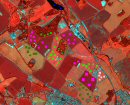
The classification lesson
applies supervised and unsupervised classification routines to identify different types of land-cover using IKONOS data from Hertfordshire, England.
Format: PDF
Further details and lesson download.
Calculating thermal stress and predicting coral bleaching
This lesson teaches how to use NOAA Coral Reef Watch (CRW) data based on satellite measurements of sea surface temperature (SST) to predict coral bleaching.
Format: PDF
Further details and lesson download.
Exploring output from the National Centre for Ocean Forecasting (NCOF)
Forecasting Ocean Assimilation Model (FOAM).
This Bilko lesson is designed to explore in a simple manner the Temperature and Salinity output generated by the operational Forecasting Ocean Assimilation Model (FOAM) operated by the National Centre for Ocean Forecasting (NCOF) at the Met Office, U.K.
Format: PDF
Further details and lesson download.
DevCoCast Lessons:
three lessons developed to support marine data distributed via GEONETCast as part of the DevCoCast project (2008-2011). Focus on Africa.
Format: PDF
Further details and lesson downloads.
EAMNet Lessons:
developed to support marine data distributed via GEONETCast as part of the EAMNet (Europe Africa Marine Network) project (2010-2013).
Format: PDF
Further details and lesson downloads.
Selected Lessons from the Envisat Module
The Envisat Module "Observing the Ocean from Envisat" looks at ocean applications of data from four sensors onboard ESA's ENVISAT platform: ASAR, MERIS, AATSR and RA-2. The module is still under construction, but most of the lessons have been completed and are available to download as single lessons.
Format: HTML with Javascript.
Module overview with links to details of lessons and downloads
Training Modules
Applications of Satellite and Airborne Image Data to Coastal Management (Module 7)
Module 7 consists of 10 lessons on the uses of airborne and satellite data for costal management. It has been updated and substantially extended for Bilko v3. Format: PDF
Further details and module download
Applications of remote sensing to fisheries management (Module 8)
Module 8 consists of 7 lessons demonstrate the use of satellite data for fisheries management. Originally written for Bilko v.2, the module has been updated for compatibility with Bilko v.3. Also available in Spanish. Format: PDF.
Further details and module download.
 Previous: Software overview
|
Last update: 31 January 2018 | Contact |  |
Site Policy |
Next: Bilko v.3 Tutorial

|


