


Mini-lesson 5: applying geographical coordinate grids to images
Lesson Aims:
|
To introduce you to how to overlay coordinate grids on georeferenced images. Objectives:By the end of this mini-lesson you will have learnt how to use formula documents to apply Universal Transverse Mercator (UTM) grids to colour composites of both terrestrial and coastal images such as would be useful for guiding field surveys. Download the lesson:
Content OverviewThis mini-lesson assumes familiarity with (a) the Introduction to Bilko Tutorial 10: Using formulas to perform calculations on images, and (b) the third part of Mini-lesson 3: Advanced use of formulas on using the modulo function to generate grids. Grids on both maps and images make it easier to locate where you are. This lesson shows you
|
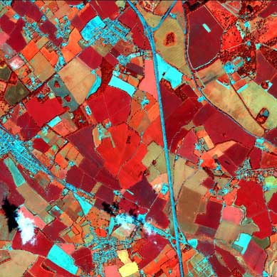
Ungridded Ikonos false colour composite of Hertfordshire farmland (UK). The near infra-red band is displayed through the red channel so that vegetated areas show up as shades of red, whereas bare soil and built-up areas show up as cyan or grey. |
In each case a sub-area of the original scenes has been sampled and the original data have been saved as pre-stretched 8-bit images. This means that you can concentrate on the process of overlaying grids along Universal Transverse Mercator (UTM) gridlines using formula documents. The Ikonos image has its origin on a UTM 1 km gridline (that is, a UTM coordinate with both Easting and Northing ending in "000.0"). The Quickbird image has an arbitrary origin with respect to the UTM system and thus you need to find the x and y offsets in order to set up the grid.
Sample images:
A selection of images from this mini lesson are shown below.
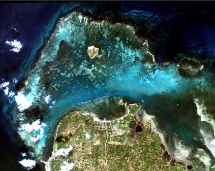
Ungridded Quickbird image of shallow lagoon to north of Santiago Island (near Bolinao, Pangasinan, Philippines) with seagrass beds and coral reef. Note aquaculture ponds (dark) along north-east coast of Santiago Island. 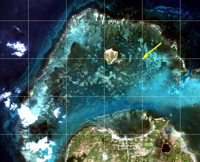
Part of the image with a 1km UTM grid overlaid. The area lies in UTM zone 50 N. The yellow arrow indicates UTM 813000.0E and 1820000.0N. An offset is applied in the formula document as the top left of the image does not lie on a UTM 1km gridline intersection. |
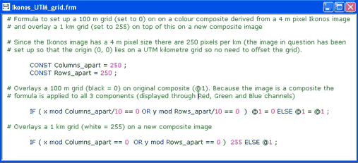
Ikonos_UTM_grid.frm: Formula to overlay a black 100 m and white 1 km grid on the Ikonos image along UTM gridlines. Since the pixels are 4 m in size, there are 250 pixels per kilometre. The x, y constructs and modulo operator (Mini-lesson 3) allow the grids to be overlaid on designated pixels. 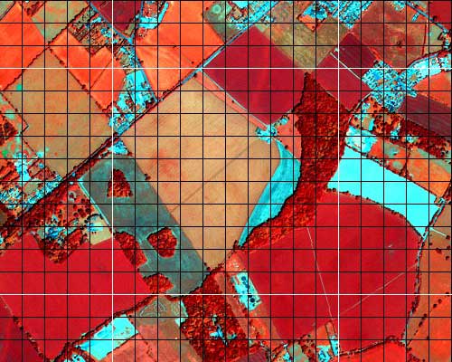
Result of the formula: Part of the colour composite with white 1km and black 100m UTM grids overlaid. |
 Previous: Mini-lesson 4
|
Last update: 31 January 2018 | Contact |  |
Site Policy |
Next: Mini-lesson 6

|